Cycling Texas : Mt Gainor Goner

Mt Gainor Goner route map

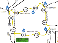
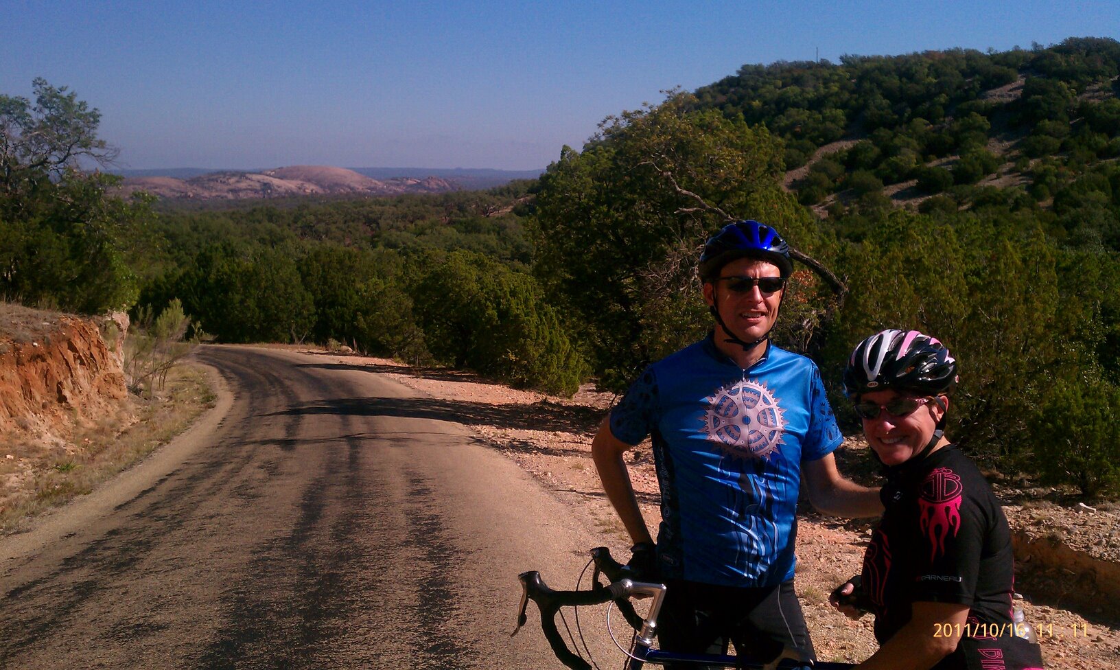
Yet another weekend in central Texas with outstanding weather provided another opportunity to seek out an interesting cycling route. This time it was down to Dripping Springs and a second shot at the Mt Gainor Goner route. Kem and I were down in the same area over Labor Day weekend and did some of this same route but we had not done the whole loop.

From Dripping Springs, the route turns out to be a 45 miler. It rolls along Creek Rd and then heads south over rolling and sometimes steep hills. None of the hills are long but the route is up and down enough it’s still a workout. Nothing but country roads and scenery – and a few cows – until you got all the way down to Wimberley. We only hit the fringe of Wimberley though before heading back. We could have probably made the loop without hitting Wimberley at all but there was no other place to stop for water and even though we might have had enough to get back, it’s never a good idea to get caught out on the bike in the middle of nowhere and run out of water. And you can never tell if you’ll get a flat tire or have some other mechanical issue that’ll cause you to be out there far longer than you imagined. We thankfully had no such problems on this ride though. Just good times.

Snapped this photo of cows along Pursley Rd.

Long horned cattle south of Dripping Springs, TX

Texas Cycling : River Region Classic 2011

River Region Classic 52 mile Bicycling Route

It’s been a very, very long time since I’ve taken the time to venture this far out into the hill country and cycle around the Utopia, Vanderpool and Leakey area. These are some of the most scenic roads in south central TX but they’re also pretty remote from Austin. It’s at least a 3-4 hour drive out there so you need to be thinking about making a weekend of it and so I did. I drove down to Uvalde on Friday and then did this ride on Saturday. Stayed Sat night again in Uvalde and took the scenic and long way back to Austin on Sunday.

The 52 mile loop route is more of a square as you can see in the route map image. Each of the 4 legs has a distinct character. The first section starting around Garner State Park is ‘lumpy’. Rolling hills. Pretty scenery and views. There’s pretty much nothing else out there until you get to Utopia. Great name for a small town out in the middle of nowhere. There’s not much to Utopia and that 2nd leg of the route is mostly flat. A tail wind at this point had most of us flying thru this section of the ride. Just past Vanderpool you make a left and head west on the most challenging part of the ride. You’re almost immediately greeted by the first of two long (2 miles long each) climbs. Grades are in the 3-4% range so not horrible but you’re huffing and puffing for a good long while. Views and scenery are great and the fast descents down curvy roads on the other side are a blast. The last leg heads south back to Garner State Park. At times you’re along the Rio Frio river. Surprisingly there was actually some water in the river, though not much. The last section is pretty flat though even a little breeze at this point felt like a headwind so I was pleased to see the finish line at Seven Bluffs cabins.

The ride was pretty well organized. Good water/food stops and support. There was plenty of food at the end of the ride too. BBQ with all the sides plus water & beer. I inhaled a plate of food. One beer was plenty.

The picture below was taken by a pro along the side of the road. He sits there all day and takes photos of motorcyclists and bicyclists. You can then find your photo on his website. It was pretty good so I bought it.

Chas on River Region Classic

Cycling Fredericksburg, TX : Little Switzerland

Fredericksburg Bicycling Route

When most people that cycle are winding down their season of riding, it’s just starting to get good here in central Texas. I’ve been taking advantage of that and trying to find interesting routes just about every weekend. One of my favorites is the “Little Switzerland” route north of Fredericksburg, TX. Click the route map for all the turn by turn details.

This route is a lot of fun. It’s got plenty of quiet rural roads without much traffic and great scenery at just about any time of year. It’s got three sections that are a bit more challenging but at 42 miles, the route isn’t likely to crater your day. North out of F’burg you climb Mt Crabapple on Crabapple Rd. I always stop at the top to look back into the valley. My favorite part of the ride is Welgehausen Rd because it offers sweeping views of Enchanted Rock. As you tear down a long descent it’s hard to take the time to stop and get a look or snap a shot of Enchanted Rock but it’s a great view and worth taking a minute. The picture below of Kem and me was taken at this point and you can see Enchanted Rock in the distance. From this point you climb an area called Swiss Miss and then head south for a long stretch on hwy 2323. For some reason the wind always seems to be coming out of the south hereĀ and it is generally uphill at this point in the route too so not surprisingly the stretch is known as the “grinder”. It fits.

After the ride it was time for a tasty brew and a bite to eat at the Altdorf in Fredericksburg.
Fredericksburg Cycling

Outlaw Trail Ride – 2011

Chas and Kem on Outlaw Trail - 2011

This weekend was the Outlaw Trail bike ride up in Round Rock. This ride’s been going on and I’ve been attending it for about as long as I’ve lived in Texas. The routes have changed over the years – it used to take you west over toward Cedar Park in the early 90’s – but in more recent years, they just head north up beyond Wier, TX. There’s too much traffic to the west.

I woke up to rain Saturday morning and I contemplated not going this year. It hasn’t rained more than a few drops here since some time in the spring so I’m ok with it raining, even if I have to cancel a bike ride. But, by all accounts, the rain was not going to last long. There wasn’t even anything showing on the radar. So I loaded up the bike and headed to Round Rock. Sure enough, 8 miles or so down the road the rain stopped and it was dry as a bone.

Several other friends were also riding Saturday morning and Kem and Tony pulled in right after I’d gotten there. Skies seemed to suggest we weren’t going to see any more rain for awhile so we got ready and hit the road about 8 with everyone else at the mass start. Despite the fact there wasn’t any rain, conditions were less than ideal. We had a wind coming out of the southeast gusting to 20+. For a ride that headed to the northeast that made for a pretty nice start to the ride. For about the first 20 miles we had a pretty decent tail wind or a little cross wind. As you can see in the photo here, at the first rest stop we were all smiles. With that wind, we were easily riding at a 20+ mph pace. Kem’s in the photo too and it was taken by Tony.

Of course, we realized that we’d have to turn back into the wind at some point. As such I was pretty sure I was going to prefer the 40-something miler instead of the 50 miler. We rode the 50 mile route for awhile but we took the opportunity to veer off when the routes diverged again. We spent most of the rest of the ride slogging against a tough wind. It was tough going. Gear down and hunker down. It’d have been easier if it wasn’t such open country to the northeast of Round Rock. Fields have been picked and in lots of places there’s no cover at all. Just wide open spaces and empty fields.