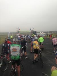
Today is the start of the 40th annual Easter Hill Country Tour. EHCT has rides Friday, Saturday and Sunday over the Easter weekend. There were 3 route choices this Friday. A 25 miler, a 49 miler and an 85 miler.
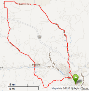
I opted for the 49 miler (which my Garmin tells me is actually closer to 48 miles.) This is a route I’ve done before. In fact, it’s frequently part of the itinerary of the yearly tour. In both 2008 and in 2011 at least the first leg of this route was also covered.
Click the map at right for all the gory details.
The first leg from Kerrville over to Ingram is perhaps the best part of the ride. At least I think so. Its only downfall is it’s hilly right from the start. But the route is otherwise the most scenic part of the loop ride. Winding, lumpy and rural.
Once you get to Ingram you’re subjected to several miles of Hwy 27 as you head west. This is a heavily traveled road though and while there’s a sizable shoulder, the road and shoulder has been surfaced with a really lowgrade chipseal. It’s essentially sizable gravel topped with asphalt and tar. It’s extremely rough even under the best of conditions and uncomfortable to ride a road bike on that has 23c 100 PSI tires. This part of the route is just to be endured.
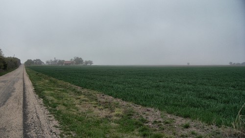
Mercifully, the route eventually turns north on Reservation Rd. There’s little to no traffic on this road and the surface improves dramatically compared to hwy 27. In fact, the rest of the ride from this point is pretty nice. This year we sailed down this leg of the route with a stiff S-SE tailwind. When you’re going 20+mph and you feel no wind at all it means the wind behind you is pretty stiff. 😉
Later of course we would need to turn back toward Kerrville and head into the teeth of that wind for the next 20 miles.
The last leg is on Ranch Road 783. Mostly this is a good road for riding. Surface is good and traffic is not bad. It picks up closer in to Kerrville. Along the way back in we were greeted by some friendly folks that figured they owned the road and standing on the horn would simply get us to pull over and let them blow by. (There is rarely a bike tour I do that I don’t encounter at least a few pinheads on the roads. Not much you can do about it. Haters gonna hate.)
Winds were stiff on that last leg of the route. All tolled, a good route and good ride which turned into a really good workout too given the wind and hills. If there was only some way to avoid that section on Hwy 27 I’d sure like this one a lot more.
Tomorrow, we take in Hasenwinkel Rd. Always a great route.