Biking the Sonoma/Napa Wine Country – Day 2

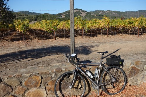
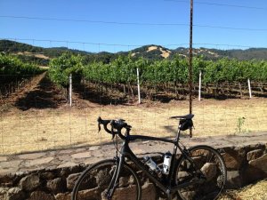
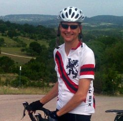
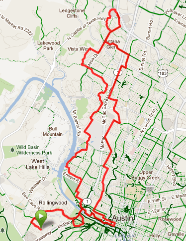
The second day of the bike tour is when things got more interesting. It offered up some interesting route options and after some discussion with the tour leads about the nature of the routes, I wanted to do Coleman Valley Road to finish. It was the longest option and finished as a 62 miler (100K). It wasn’t the mileage I was interested in, it was that the Coleman Valley Road was supposed to be the more scenic option. Check out the full route map and details here.

Half the fun of these trips is the food and breakfasts are no exception. On this morning we started things at the “Big 3“. I went with a big omlet. Tasty.

Weather kinda sucked to start with. We knew it’d get better later, but it starated chilly and foggy. I was very glad I had brought along plenty of layers. The weather in the area at this time of year appears to start off chilly if not downright cold (40’s) and later warm into a sunny livable 70’s. Full finger gloves, a jacket and leg warmers were in order.

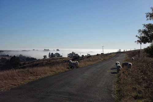
We trekked up Arnold Drive that morning, out of Sonoma and through Glen Ellen. Traffic was not bad though the cars are fairly plentiful on that road. From there we started a significant climb up Sonoma Mountain Road. This was a winding, hilly and potholed road. Pretty countryside though. Long climb and we warmed up quickly. The descent was rough on that road. The potholes made it more technical than it might otherwise have been. We quickly reached the lunch stop though at Matanzas Creek winery on Bennett Valley Rd.

Turns out I’ve been to this winery a few times and was already a member. They treat members nicely so Stephanie behind the counter offered up several wines not otherwise on the Backroads tasting menu. As usual, it was all very good stuff.

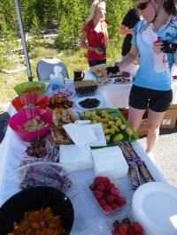
After another fantastic picnic lunch at Matanzas Creek and more than enough wine to choose from, we were off to finish the rest of the day. The majority of the ride was still before us. Coleman Valley Road had been billed as being the scenic option so I was up for it but it was also the route with two more tough climbs on it to end the day, and an interesting descent as it turned out.

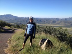
The climbs up Coleman Valley were indeed tough and by that point it had warmed up considerably. I had almost left my jacket in the van along the way. Glad I didn’t. After climbing, the view at the top was wonderful. Long vistas to the west. By this point in the day it was also becoming apparent that fog was going to be rolling in. In the distance you could see it in the valleys. As I approached the coast, I knew there’d be a descent down to Hwy 1 and into Bodega Bay. Up ahead I could see that that descent would be into thick fog. From sun to thick fog in short order. The temp drop dramatically. Really thankful I had my jacket with me. I put that on and headed down. Brrr. A very steep, curvy descent over several cattle guards. Very cool though, literally and figuratively.

At Hwy 1 it was a left turn and 3 miles or so to the hotel for the evening. The Bodega Bay Lodge. Hwy 1 isn’t my favorite place to cycle. While the traffic isn’t terrible, it’s still a major highway and traffic goes by at considerable speed. Occasionally there’s a shoulder along the way but it’s not consistent and often full of debris like gravel.

Made it in fine though and it was time for snacks and yet another big dinner at the hotel. That night I think we earned it.

Biking the Sonoma/Napa Wine Country – Overview and Day 1

It’s been over a year since I’ve done a bike tour of significant length and off in some interesting locale. I routinely search for interesting tours but the timing has to be just right because of my work schedule. So this year it worked out October had some time. After a fair bit of searching, I landed on one offered by Backroads.

In a nutshell, the tour was billed as the Napa/Sonoma wine country tour. 6 days of riding in the beautiful California wine country. Sounded good to me.

I’ve known about Backroads for ages but never booked them because they seemed to me to cater more toward really plush tours – not to mention they are also more expensive than average. I thought it might imply the routes might be boring or easy or both and it’d be entirely filled with first-timers. Turns out at least for the tour I booked, most of that wasn’t true. It was indeed plush – more on that later – but the routes turned out to have some great options and I found a few people I enjoyed riding with.

There were indeed some first-timers on the trip but there were also vets of other tours. For a group this size (23 of us and 3 guides) most people got along very well and the tendency I have seen in other tours of that size to have cliques form that never cross paths after the first day or so didn’t really happen. In a group this size there’s ‘always at least one’ person or couple that doesn’t quite fit the mold and that was true in this case too. Funny how consistent that has been over the years. Otherwise, the demographics were what I expected. People my age or a little younger, professionals.

Logistics for this tour were a little more challenging than others. Partly because there wasn’t airport pickup built into the plan. Instead, we started from a hotel in downtown San Francisco and later returned to the same hotel. But the transfer from the hotel had to be made independently. Why that couldn’t have just been arranged by Backroads I don’t know. Because we ended on a Friday it seems natural that some would just want to hang out in the wine country till Sunday and then fly home but there was no accomodation for that. And renting a car in the wine country after and returning it at SFO later is more costly than most would want to arrange. So in my case I ended up going to the hotel after and then SFO to get a car. It amounted to 6 hours out of my precious vacation in transfer time.

Enough of that and on to the cycling. After shuttling to Etude winery, we immediately got exposure to the Backroads touch. There was a wine tasting at Etude followed by an elaborately prepared gourmet picnic lunch. Nice. Who’s ready to ride!? I really should have taken pictures of the lunches. The picnic lunches were outstanding.

Time to ready the bikes… I brought seat, pedals and helmet and my own bike computer. A bike comes with the price of the tour and by all accounts on the website it seemed like a nice enough one that I didn’t need to bring my own. I missed my own as it turns out but the rental bike was actually a nice bike. It just wasn’t the same perfect fit as my own bike. The bike was a titanium frame with either Shimano 105 or Ultegra or in the case of the rear derailleur some mountain bike component. Gear ratios were plentiful. Triple crank with (I didn’t count) probably at least a 30 tooth cog in the back. Some really low gearing available and I appreciated that later. It was a decent bike and suitable to the task.

The ride that first day was easy peasy. We rode from Etude over flat country to Sonoma and to the Sonoma Mission Inn. Weather was fantastic. Warm, sunny and just right. Click through for the route and details.

The Sonoma Mission Inn is plush, very plush. The highlight was the spa and the Santé restaurant.

As guests, we had at least the “bathing ritual” access to the spa. That alone was nice because it included showers with exfoliating scrub, hot tub, steam room and sauna. With only 20 miles under our belt it hardly seemed like we’d earned it but it was sure nice!

Did I mention the wine? We’d already had a wine tasting at lunch, then along the way we stopped in and had a fantastic tasting of wines at Ravenswood and once we arrived at the Inn there was a complimentary (er, included) bottle in the room and then more to choose from at a meet and greet at 6pm at the fire pit at the Inn. Oh, and of course we could order more with dinner later too of course.

Dinner at Santé was excellent. We dined in 3 groups but in the same room. I went with the heirloom tomato salad, a filet and some ice cream/fig type dessert I couldn’t possibly remember exactly but it was all very good.

First day ended with everyone clearly getting to know one another. Some nice folks on the tour. Doctors, lawyers, business owners… from USA, Canada and Mexico.

Biking the Marin Headlands Loop

I’ve wanted to bike the Marin Headlands for some time now and there’s never been time on other relatively recent visits out this way so I took the opportunity on this visit to work it into the plan. From the city it’s not actually all that long a loop ride so it’s reasonable to assume you can leave from pretty much anywhere in the heart of the city to get out there.

I neglected to bring my Garmin handlebar mount so I didn’t have my bike computer onboard my rental bike so here’s the best I can do based on a quick google search to illustrate the main part of the loop in the Marin Headlands. (Later in the day I found a bike store to buy another Garmin mount for the week ahead.)

First off, it was downright chilly here when I left this morning and headed toward the bridge. Here in the city at 8:30 in the morning it was clear, bright and sunny. Still though, pretty chilly. 50’s? Not sure. I was decked out in bike tights and a long sleeve bike jersey over a long sleeve shirt. Warm enough.

By the time I got to the bridge though it was pea soup fog. Visibility was poor. Still though, I was one of many, many cyclists heading north at that hour. I’m guessing that’s pretty typical. In fact, on the weekends, the routes are such that cyclists must take the western side of the bridge and pedestrians must take the east side of the bridge. That’s good because given the number of riders going both ways up there it’s tight quarters and it would be a mess up there if bikes and peds were going both ways on the same small patch of sidewalk on the bridge.

In the distance, the fog horn in the bay sounds remote and forlorn. On the bridge itself it seems pretty apparent the horn is right there on the bridge. Wow, it’s loud! The horn of a ship passing underneath was added to the noise. Too much fog to see anything though. I could only hear it.

There are a ton of riders taking off at that time of the morning and heading north. Where to? who knows. But there are a lot. And many are the pedal pounder type. Off to the races. As fast as you can go. So, despite limited space, bike traffic both coming and going and thick fog, they’re passing in groups and weaving in and out at top speed. I was just happy to hold a line and avoid getting run over.

Once over the bridge you quickly begin to climb. I was thankful I had rented a pretty light road bike with low gearing. In fact, the bike had SRAM Apex gearing. This is a double crank setup that basically matches what I always ride. After climbing a bit I stopped to snap some pics. I’ve included one below. You can see the fog I rode through to get there. In the fog, you have no idea that it’s clear just a few feet above your head.

A Fogged In Golden Gate Bridge from the Marin Headlands

The climb up wasn’t all that bad though I would have really liked to have my pedals and my bike shoes. Traffic was surprisingly light at that time of the morning and at least on the climb there was no fog. It was glorious sunshine. Eventually you reach the peak of the climb and if you’re going to continue on around the loop the road turns into a one lane road. And it drops quickly. It’s a very, very steep descent. On my own bike I’d have felt more comfortable. On a rented bike, I always wonder about the brakes and gear in general. It’s foggy, it’s steep and a one lane road. Just off the road is an abyss. Hang on! We’re going for a ride!

As the apex of the loop flattens out again the fog lifted and I was headed back inland. Eventually I rode though this very cool tunnel that emerges on the east side of hwy 101 and it’s a short ride from there to Sausalito. From Sausalito, it’s then back to the western side of the bridge for the ride back into the city.

The pic below was taken after making the trip back across and under the bridge. By then the fog had cleared from around the bridge. Excellent view point. Don’t miss this ride if you like to cycle and you get the chance.

Golden Gate from San Francisco Side of the Bridge

Annual LBJ 100 Bike Ride – 2013 Report

Yesterday it was time once again for what is now the 6th LBJ 100 bike ride. This is my 3rd. Conditions were a lot like last year – except not quite as photogenic. In fact, if you link through to my write up from last year much of those notes hold again for this year. The ride is well planned and I’d say logistics were even better this year. Gone was the crazy late registration tent a half mile from everything else and there was less fiddling around at the beginning of the ride. There were intros, a short talk by Luci and then we were off in waves. At the end of the ride, they also had people driving out to the north instead of through the finish line like last year. Maybe people just did it wrong the last couple years.

The price had gone up to $55 for late registration – a price I still maintain is too high for these kind of events. Skip the shirts and water bottles. Keep everything else. At least they had shirts for late registrants this year though.

Sausage and beer at the end of the ride. Same sausage arrangement as last year. Gone was the potato salad and instead there was mounds of corn plus some cole slaw with cranberries in it. Actually the combo worked pretty well. This year in addition to 3 beers from Pecan Street Brewing there was also Lobo from Pedernales Brewing.

I did the same route as last year too. In both cases I wanted something between the 42 and the 62 miler so I did a little mixing and matching of the routes to come up with my 54 miler alternative. I haven’t had a lot of time in the saddle this year so the 54 miles was plenty. I hit a wave of fatigue around 40 miles into it but it wasn’t too bad. If you click thru that link to the route you’ll see you do a bit of climbing before hitting mile 41 and then it evens out and is mostly even down hill toward the end. There’s also a handy rest stop about 8 miles from the end.

Wild flowers were not as prevalent this year. I didn’t even bother taking pics. Click thru to last year when they were in abundance. The pic below is maybe 10 miles into the ride along North Grape Creek Rd. Here’s the google street view of that spot.

2012 River Region Classic – Ride Report

Finally getting around to posting some notes on the 2012 River Region Classic. This is the 2nd year in a row that I’ve made the trip out to the Leakey area to do this ride. I enjoyed the 52 mile route last year and this year I managed to convince Tony and Jim to join me as well. Jim’s got a friend that has a place to stay out there just north of Leakey. Very handy. Jim’s friend Pat joined us too.

If you linked through to last year’s post you’ll find a surprisingly similar photo of me. This year I was ready for the guy at txmotofoto.com and gave him a big smile and wave. The photo turned out pretty good I’d say.

No surprises on the route this year. Having done the same route last year I was more than aware of the big climbs in the latter half of the route. Tony and I have been riding a fair bit this year and made short order of the back to back climbs. The descents on these climbs and the scenery make the huffing and puffing worth the effort. Something Jim had eaten had him feeling pretty punk before we even started and he just wasn’t feeling well on the ride. We didn’t see much of him till the end. Pat did the 100 miler and took off fast. We never did see him again. He finished much later then we did and headed back to Austin as soon as he did.

Rest stops again this year were well stocked and nicely spaced. I don’t think the food at the end of the ride was as good though. This year there was some BBQ chicken but it was a tiny little squab. The potato salad was kinda runny and blah. I was starved though and gobbled up anything available. There was a keg of beer available too. I don’t know what kind it was but it wasn’t really hitting the spot either. All in all we took time out later and ate at a Mexican restaurant in Leakey.

This route is one that could be done on your own pretty easily without much support and that’s likely the way I’ll do it again in the future. There’s a general store at the start of the route where you can stock up and then you’ve got places in Utopia, Vanderpool and Leakey that you can restock. No doubt I’ll be back some time. The route is great for cycling.

Update: One last photo of Jim and me at the end of the ride, taken by Tony.

Ft Davis Cyclefest 2012 – Ride Report

McDonald Observatory Summit

Cyclefest is an event I’ve heard about for years but I’ve never taken the time to travel to it.

Cyclefest is put on by the Permian Basin Bicycling Association out in Ft Davis, TX, and Ft Davis is way, way out in west Texas. All these years I’ve lived in Texas and I’ve never been to west Texas yet. So this year I signed up and geared up to make the long trip. Somehow I managed to convince Tony to join me and we loaded up their Honda Element and hit the road.

In my estimation it’s a pretty good drive just to get down to Kerrville but getting out to Ft Davis is 350 or so miles more west of there. We left Austin in the morning and spent the better part of the day driving west. We got gas in Fredericksburg and then pulled in for food in Kerrville – oh, and pulled into Specs too since we didn’t figure we could find a decent bottle of wine for another 350 miles.

I10 is a long road and there’s not much to look at. Tony was going 80mph and it seemed like we were standing still. The Honda Element is basically a box on wheels though and at that speed it drank gas like you can’t belive. Somewhere west of Ozona Tony looked down and realized we were about out of gas. Uh oh. Not good. There’s literally nothing out here. The gas warning light went on… We dug out the owners manual. We had about a gallon left. Not going to make it to Ft Stockton… Somehow our prayers were answered though and at the Bakersfield crossroads we managed to see an Exxon sign! Click through to see what I mean. There’s nothing around except for a tiny little Exxon. Saved!

The plan for Saturday was to cycle a scenic 75 mile loop from Ft Davis. About 5am though I woke to the sound of rain. I looked out and sure enough, a steady rain was going. You don’t expect a rain to last too long out here. It’s very arid most of the year. The temps were hovering in the mid to upper 40’s. Not good. I rolled back in and hoped it would move on. At breakfast a bunch of folks that were staying at the B&B were all geared up and ready to ride but nobody was too excited by the prospect of riding in the wet, cold weather. It was still raining. It kept raining. Sigh.

By 10am some hardy souls decided they would give it a go. It was still raining and hadn’t made it to 50 degrees yet. From the porch I wished them good luck. Not my kind of weather.

In another hour or so though it let up. Not great weather but at least it wasn’t raining and radar showed it’d moved on out. Probably not a good day for getting the 75 mile loop in so we loaded up the bikes and drove them out along the route. We parked and got maybe 30 miles or so in that afternoon. Not what we had geared up for but we enjoyed the ride and scenery even though temps were chilly and skies were grey.

By Sunday morning though the weather was pretty close to perfect. Skies were clear and it was chilly but just right for riding with some cool weather gear on. Destination: the McDonald Observatory. We left from Ft Davis and biked all the way out. We thought we would catch up to other riders for a mass start at the Prude Ranch but there was nobody there. Only later did we come to realize that the mass start was from a spot further up the road. We missed that mass start but it didn’t matter. We climbed to the top just the same. As it turned out, we caught up the the tail end of the mass start group by the time we hit the step section that climbed up to the Observatory. The photo above of me is after we’d climbed to the top. Nice view from up here!

The ride from Ft Davis up to the Observatory is steep and challenging but not as difficult as the European climbs I’ve done. Those were overall longer and steeper. Still though, this is a great ride! We particularly liked the ride back to Ft Davis. We rocketed back down the hills and practically coasted into Ft Davis.

I would really like to see what the 75 mile loop ride is like though and so I hope one day to return out to Cyclefest and take that ride in.

The photo below was taken later in the day after cycling and before the sunset. We drove into the Fort Davis State Park and up into the hills. The views in all directions were great. The setting sun made for some great light for taking a few photos.

Looking East over the Davis Mountains

Looking East over the Davis Mountains

Cascades Gran Fondo 2012

The primary motivation for heading to Oregon in the first place was to attend this cycling event. I had no context for it. I just knew I liked the area and it has been a fantastic place to visit in the summer so I thought I would give it a try. I ended up enjoying it a lot.

The event turned out to be a a little smaller than I imagined it would be. As you can see in the photo of the start of the ride, there were maybe a couple hundred people in attendance. I’m not sure what I expected but I expected it would be larger – maybe many hundreds, even a thousand. The ride started at the Mt Bachelor ski resort parking lot. There was just a little bit of snow left up on the mountain but certainly not enough to ski on. The parking lot was otherwise barren except for those that were at the Gran Fondo.

The was some speechifying at the beginning of the ride but not much. Chris Horner is a pro that races for team RadioShack Nissan Trek and is the host of the Gran Fondo. He spoke a bit at the start and then we were off. Weather was ideal. Even up on Mt Bachelor the morning temps were fine. The photo of me here is with Chris Horner after the ride. Nice guy though we didn’t really chat more than a few words. He took off initially with the ‘Full Gran Fondo’ which was 75 miles. I chose to do the ‘Mid Gran Fondo’ (53 miles) and because the routes deviated, I never did see Chris out on the road. He was host and visited with people and consequently I finished before him because I was doing a shorter ride.

The ride was well supported and as you can see in the photo here the rest stop snacks were top notch. Water, fruit, chips, cookies… plenty of stuff.

A Gran Fondo is a timed event like a race but it’s an open event than anyone can attend and in that respect it was organized and felt just like any charity ride I do around Austin. But being timed, there was competition and prizes for winners. The 75 miles took off fast and raced the whole way. Even though I was on a shorter ride the race group (which was maybe a dozen strong) passed me well before I neared the finish.

Climbing back up to Mt Bachelor toward the end of the route was a pretty good slog but it was not all that bad. The grade was steep but not horrible. The annoying thing was just the traffic. That part of the route back to Mt Bachelor was more heavily traveled.

I ended up keeping pace with and riding with the same people most of the way. That’s not unusual with these kinds of rides. So when we finished the ride and loaded up on food, we ended up eating lunch together too. I didn’t recall enough about them to capture any notes here but it seemed they did this sort of event often. Food was pretty good and I was plenty hungry. I was glad to have finished the ride plenty early. The wind was starting to pick up and became a real annoyance as we ate lunch. Hard to keep your plate from blowing away.

I liked the route and would consider doing this again. Not sure I’d arrange it so I’d go back to the Gran Fondo or not. I guess it would depend when it’s scheduled, but I’d definitely go back to that part of Oregon again and cycle. It’s beautiful countryside.

This final shot is of Mt Bachelor in the distance along the ride.

Cycling Sonoma, June 2012

Sonoma Cycling and Vines
The view from Trinity Rd just north of Sonoma and on the way to Napa

I had the pleasure of being in the San Francisco area for a conference at the end of June. Given how blazingly hot it’d been in Austin, the weather in SF was a welcome change of pace. I could fly back right away that Friday the 29th or I could hang around a little and enjoy it a bit. I chose the latter.

I found a great place to stay right close in the town of Sonoma and they put me in touch with the Sonoma Valley Cyclery bicycle shop that was literally about a block and half away. I called in advance and reserved a bike. You never know what you’ll get when you rent a bike so I was wary but it turned out they had some really nice bikes to rent. I got a 58cm Specialized Roubaix. It wasn’t a perfect fit but it was much better than I thought it would be in terms of fit and ride. I brought my own pedals and seat as well so aside from a reach that was just slightly too long, the fit was excellent.

In advance of heading out there I’d done some googling for a good route to ride from Sonoma. It didn’t take long to turn up the “Cavedale – Mt Veeder” loop ride leaving from Sonoma. There’s a great write-up with links to a map and tons of info on the Santa Rosa Cycling Club website here.

The route as described on that site is 46 miles. The route as I ended up doing it was actually about 51 miles. The main difference in my alternative was to take Verano Ave over to Arnold Rd instead of taking Hwy 12. The bike shop had suggested this would have less traffic and I was more than fine to have fewer cars in exchange for a few more miles.

As it turns out, Arnold is still a fairly busy road, even at 7:30 on a Saturday morning, but nothing compared to hwy 12. So, it’s a good choice.

As you can see from the ride profile picture from my Garmin below, the route quickly hits a wall when you get to Cavedale Rd. It’s a challenging climb that goes up a couple thousand feet at grades averaging maybe 9%. Though it is a difficult climb over a single lane road that is not all that well maintained, there is almost no traffic at all on the road. Unless you live up there or are trying to get off the beaten path, there’s no reason you’d drive up that way.

The views along the way are great and I stopped several times just to look out over the valley. I was particularly fortunate that morning to have clear blue skies.

After reaching the summit, the ride down Trinity Rd on the other side was fantastic. Eventually it turned onto Mt Veeder though and once again you begin to climb. This section has shorter climbs then Cavedale but they’re even steeper. Even I was out of the saddle and I almost never get out of the saddle. I prefer to spin. In fact at one point with such a light carbon bike, I found myself pulling the front wheel off the ground as I cranked up the hill.

The fire station at the end of Cavedale Rd does indeed have a spigot you can replenish water. The area is otherwise devoid of businesses to pull into to top off water. I had a camelback full of water plus 2 water bottles that day though so I had plenty of water. When I finally rolled into Napa I took a detour to the market described by the Santa Rosa club writeup. Wasn’t far and well worth the stop.

The southern section of the loop ride back to Sonoma from Napa isn’t quite as scenic as the northern half. While there are some rolling hills to get over it’s mainly a flat section of open countryside. Scenic in its own right, there is little if anything holding the winds back and the winds were up that day. Going east to west back to Sonoma I was heading into the teeth of the wind. Other than that, it’s not a challenging section and before you know it you’re back into Sonoma.

This was a fanstastic route and I would definitely recommend it. Start early and spend the rest of the day at the wineries. 😉

Sonoma Cavedale loop ride profile

Another good Bertram to Burnet Ride

Chas biking to Burnet

This weekend’s ride with Jim and Tony was an old familiar favorite. Click through the link for the route map. This time we did the ride clockwise in part to avoid a steep climb when you do it counter clockwise. In the end, of course, the elevation gain over the course of the loop ride is gonna be the same, but the grades in a few places are different so it can seem slightly less intimidating.

We were fortunate to have cloud cover for a good portion of the ride. When the clouds lifted and the sun came out it was obvious it was going to heat up quickly. We’d gotten a fairly early start at 8:30 but that still had us out there late morning to finish up the 40 mile route.

A stiff wind out of the southwest had the first part of the ride kind of a slog. Once we rounded the corner of the loop though and headed north toward Burnet we made really good time though.

We stopped at one point and took a few pics with the phone cameras. Tony snapped the one of me alone and then Jim took the one of me and Tony.

Chas and Tony en route to Burnet, TX.

Liberty Hill to Bertram, Just another Sunday Bike Ride

Route map

Today’s ride was planned kinda last minute. We’d thought about doing a ride out of Blanco that mimicked yesterday’s Real Ale ride but it wasn’t in the cards today. So Jim and I ended up going for an old familar favorite out of Liberty Hill. The route picture at the right shows today’s 36 mile loop. Click here for the details.

This is always a scenic ride and traffic is usually pretty limited on all the roads. I like doing it counter clockwise because it’s more scenic on the south side of the loop as you finish up. You’ve got to cross hwy 29 a couple times – once in Liberty Hill and then again later in Bertram – and that traffic was pretty high today, but thankfully we didn’t actually have to ride along hwy 29.

Central Texas is still surprisingly green and the temps are surprisingly moderate compared to what we’ve come to expect for late May. Usually by now it’s getting just plain hot. But with some cloud cover and a light breeze, it was down right pleasant out there this morning.

Despite low traffic on the roads, a ride out this way doesn’t seem to be complete without a few knucklehead drivers to give you grief. Today was no exception. Early in the ride a cretin in a black pickup floored it and blew by us at full throttle. He was easily going 80+ by the time he blew by us. Why? who knows. We were single file on a rolling country road. The road is probably unsafe at 60 mph. A complete pinhead.

Later in the ride, a black SUV gave a quick swerve toward us on a straight wide section as we headed back to Liberty Hill. More friendly hill country cedar choppers thinking it’s fun to put the fear of God in us I guess. Where does this kind of thing come from? I can’t explain it. Yeah sure, there’s probably a few bad apple cyclists that at some point have been hogging the road out there and made them slow down a second or two but it’s still uncalled for. It’s unfortunate some cyclists feel entitled to take the whole road at times but there’s got to be something more to it than that.

Anyway, it was otherwise a good ride. I had to stop and take a picture of a favorite windmill scene I’ve ridden by many times over the years but have just never taken a photo. Today the cows, colors and windmill made for a good shot and I snapped this one. I took it with the iphone camera and it still came out pretty good I think.

A favorite windmill spot that just happened to have cows in the foreground for a change.

ExperiencePlus! Northern Argentina Bicycle Tour 2012 – Day 2

Chas and cactus at the ruins in Tilcara
Herb north of Tilcara

Day 2 of our tour was the first we’d actually get some riding in. All the gear we’d brought – pedals and seats – were fitted and we made adjustments. I’d sent my bicycle geometry in advance and aside from fitting the pedals and seat, I didn’t have to adjust anything. Later it would be clear the headset had some issues and they would eventually replace it but it wasn’t a major problem. Just maybe a little unnerving to hear that thing rattle every once in awhile when the going got bumpy.

Our first day of riding was a pretty easy one from a level of effort perspective. Ultimately our landing point for the day would be Purmamarca and but because that wasn’t very far away and it’d be interesting to say we’d made it to the Tropic of Capricorn we first rode north till we got to the sign that marked the Tropic of Capricorn and then turned around and headed back south.

There aren’t that many paved main roads up in that part of the world. The road we traveled was a pretty major road. There wasn’t a ton of traffic but there was enough traffic to make you a little nervous. It became clear early on that Argentine drivers don’t give cyclists all that much room. Certainly it was less room than I typically get around Austin except in rare instances. That a significant chunk of the traffic was gigantic double decker buses crusing along at high speed made such encounters pretty unnerving. More than a few times I pulled it off the road and into the gravel shoulder when I heard or saw one of these buses coming. The gravel shoulder isn’t ridable for a road bike so this amounted to coming to a full stop when they went by.

There were fully loaded cyclists out on the same road that day. They were riding in a pack and generally on mountain bikes with panniers so not hard to catch and pass. I stopped and snagged a picture of them along with Herb, one of the guys on our ride. They were in it for the long haul. My Spanish is non-existent and their English was not so good so I had a hard time recognizing where they said they were going.

The early part of the ride went north and winds were light. Neither lasted all that long. We circled back once we hit the Tropic of Capricorn and headed south to Purmamarca. The winds picked up and what was otherwise a slight downhill into Purmamarca turned into real work against the winds.

Chas at Tropic of Capricorn

ExperiencePlus! Northern Argentina Bicycle Tour 2012 – Day 1

On the way to Tilcara
Church in Tilcara
Hotel Viento Norte
Hotel room view
Because I liked the shadows

Day 1 of the tour – a Monday – was mainly about shuttling up to Tilcara and meeting up with the folks we’d all spend the next week or so with. Tilcara is way up in the far northwest of Argentina and by the time you get there you’ve gotten into the mountains. At 2500 meters, our stop for the night was around 8000 feet above sea level. I didn’t notice a problem with the altitude though apparently it’s the sort of thing that can creep up on you.

We left Salta a little after 2pm and it was easily a 3+ hour van ride up to Tilcara. The terrain in Tilcara is much different than down in the valley in Salta. Mountainous, dry and populated with cactus. Tilcara is a dusty little town – like many of the small towns in this area. Dusty in the sense that most of the roads in the town are dirt and gravel and there was a bit of a breeze by the time we got into town. Seemed a little like something right out of a spaghetti western. Rooster’s crowing. Stray dogs everywhere.

We arrived at Hotel Viento Norte with just enough late day sunshine to catch some good photo opportunities of the hillsides surrounding Tilcara and a few in town. A couple of us wandered further into the town and found the main square. (A few blocks.) Across from the square was an old church. We snagged a few photos and then needed to make our way back for the first group meeting. Time to meet and greet and have some snacks, wine & cheese before dinner. Most of us of course had already had some time on the 3 hour ride up to get acquainted, so intros were pretty brief.

As I mentioned in an earlier post, everyone on the tour had done more than one tour like this before. The fewest I think was 3 tours like this. The oldest guy was 76 years old! followed closely by another that was 75 and then the rest of us are somewhere maybe near or north of 50.

Dinner the first night was right there at Viento Norte. Really enjoyed it! It started out with a vegetable soup that was delicious. Not sure how it was prepared exactly but it was less broth than vegetable soups often are and more pureed vegetables. Enjoying the soup might have been helped by the fact it cools off pretty quickly in the evening at that altitude. There was also a green salad with tomatoes, local corn (which has a very big kernel and is lighter in color and certainly a lot less sweet that we would typically see) some cheese (not sure what kind) served over a bed of quinoa. Quinoa is big up there.

That was followed by tamales and humitas. The tamales had pork in them along with their corn filling. The humitas we were told included cheese though I’m not sure what kind. Both really tasty. Wine along with dinner was a Malbec from Elementos (Bodega Esteco and one we’d at least bike by later in the tour). Also very good. For dessert, we had something I’d never had before: a green squash that was sweet but not too sweet – how it was sweetened I don’t know – topped with some nuts. I don’t know the name of this one but I thought it too was very good. I could only eat so much of it though. Very sweet.

We were up bright and early the next morning for breakfast and then bike fitting/setup. I brought pedals and seat as had most people. At least most people brought pedals. Not everyone brought a seat. I can’t imagine switching to a different seat for days worth of riding.

ExperiencePlus! Northern Argentina Bicycle Tour 2012

Jackson Square

My bike tour through northern Argentina is coming to close – or more likely has come to a close by the time I actually finish this and post it – and it has indeed been a fun adventure. I didn’t really have a lot of expectations about Argentina or what to expect of this tour since I didn’t know anyone beforehand that had done a tour with ExperiencePlus! and in recent memory I’ve done tours that I’ve either gotten some good word of mouth about or a tour company I’ve used before. But I was impressed with the how well it was organized and the very good work of our guides on this tour. While you pay for the privilege of such a supported tour, in a foreign land with a language you don’t know I believe it is worth it.

While I saw a very small slice of the country over two weeks, I naturally formed some opinions. The contrasts in Argentina are vast. Clearly a developed country and economy it’s like visiting Europe – only it seems more generally dilapidated in many towns and cities. (More on that in a future post.) But the beauty of the countryside, the friendly people we encountered and the great food and wine made the trip a very worthwhile experience.

The Ridiculously Brief Summary

  • Lots of connections to get there: Austin – Houston – Buenos Aires – Salta … Tucman – Buenos Aires – Houston – Austin. Travel by air is more exhausting than cycling.
  • 357 miles (575 kilometers) of cycling that began as far north as Tilcara and the Tropic of Capricorn and stretched as far south as San Miguel de Tucumán. All of it is still considered northern Argentina, which is a vast country.
  • We passed through 3 provinces of Argentina: Salta, Jujuy, and Tucman.
  • 9 days of cycling over 12 days
  • Both easy cycling and challenging cycling (for a variety of reasons) but overall, not as challenging as others I’ve done.
  • 3 flat tires – one by glass, two by cactus thorns
  • lots of great food and wine
  • more diesel fumes and exhaust than I ever cared to inhale
  • hands and feet as cold as they’ve ever been
  • as many buses as there are stray dogs
  • beautiful countryside and friendly people
  • and an appreciation of a country and part of the world I had little or no insight into before the trip

Let’s Start At The Beginning

Salta was the meeting point for our small group of 7 riders and 2 guides. Salta is about a 2 hour flight from Buenos Aires. I’d arrived a couple days in advance as I often arrange just so I can get acclimated. Our group included:

  • Ole – age 76 and just coming off some other active tour in Brazil and after this one, headed off to another active tour in Patagonia.
  • Herb – age 75 and veteran of more bike tours (self organized and fully supported) than I can recall or recount.
  • Bob and Mary Ann – a couple somewhere around their 50’s and veterans of similar tours around the world.
  • Grant and Dona – a couple around their 60’s and also vets of similar tours in other parts of the world.
  • Tika and Anibal – our patient and friendly guides from Argentina.

One by one our group met up at the designated meeting hotel. We’d eventually return to the same hotel a few days later when we returned to Salta on our way further south. Ole was the first one there and drinking a glass of wine at the sidewalk tables and immediately offered to share the other half of a sandwich he didn’t want to finish. Herb joined us and stories of tours and past travels began. It was evident early that folks were going to get along just fine.

We all loaded up a big van with our group and all our luggage and 3 hours later – and introductions all around – we arrived in Tilcara, our stay for the evening and the kickoff of our cycling tour. More on that in the next post…

2012 LBJ 100 Ride Report

Bluebonnets
Chas and post ride beer

This is the 2nd year I’ve done the LBJ 100 bicycle ride. I’m guessing the ‘100’ in the name would be for the 100K route because I don’t think there is a 100 mile route on this ride. There are routes of 30, 42, 62 and 85 miles.

I like this ride. It’s pretty well planned and the logistics at the start and finish out of the LBJ ranch work out pretty well. The last couple years they have also gotten a couple interesting booths to show up and the post ride meal and beer are very welcome after the ride. They also get points for arranging enough portable toilets and having really good rest stops.

We joked last year that there was an awlful lot of speechifying at the beginning of the ride. I recall Luci Johnson talked for what seemed like a long time. This year there seemed to be less of that but in its place was a staged photo/video op of a classic Lincoln Continental driving through the line up of cyclists followed by a set of ‘Wounded Warriors’. All that’s well and good but the reality is 98% of the folks in attendance came there to have hours of hill country cycling ahead of them and they just want to get on with it.

It’s a charity ride so you don’t feel completely put out by the $50 price tag for joining the ride (if you register on the day of) but it’s still pretty steep. Most people expect to do several of these charity rides in the spring and fall. At $50 a pop, I guarantee you that in some cases there are plenty of people that just ride, skip the payment and enjoy the open road. Like so many of these rides, there’s a shirt that comes along and often they throw in a water bottle too. This year’s ride had a shirt I might actually like. It was a technical material that I like better than your typical cotton t-shirt. Unfortantately as someone that registered on the day of – at full price – the only shirt I could choose from (at the conclusion of the ride, not before) was a XXL. You could fit 3 of me into a XXL. It’s a nightgown. With iffy Spring weather, I rarely register early. It’s irritating to shell out $50 on top of the $4/gallon hour+ drive. With this ride on the same day as the Rosedale ride, it’s impressive that they get upwards of 1400 riders on this ride. My advice: skip the shirts and water bottles and charge less.

Rest stops were good. All had ‘Gu’ (sponsor product) and things like water, gatorade, pickle juice, peanut butter and jelly sandwiches and slices of bananas. There’s no place to stop out on these routes so your really rely on the support. If you packed a lot of water and food you could do it without the support but why worry about it.

Weather this year worked out fine. The morning started out gorgeous. Chilly but with a little ground fog (see picture) that made for some beautiful scenery at the ranch. Shortly after sunrise though the sky became completely cloudy, and a little misty. Not a full on drizzle or rain but just a little mist and cloud cover. Actually, not a bad situation to ride in at all. The temp was quite nice and the pace and hills at the start of the ride warm you up quickly so you appreciate a little mist.

There were plenty of wildflowers along the roads this year. The Bluebonnets were in abundance. I stopped and snapped a picture to make it official.

Post ride, there was lunch that included sausage, potato salad and a salad. It hit the spot. So did the beer provided by Pecan Street Brewing out of Johnson City. I tried the wheat beer. Mighty tasty after a ride.

Sunrise over the LBJ Ranch

Rambling Through Austin

Central Austin Bike Route

Great weather in Austin today and Tony and I did a ride from just south of Rollingwood all the way up to the Arboretum and back. You can actually get a pretty decent ride through the central city and steer clear of most busy roads – not without a few hills though. I hate riding Highway 360 through town despite how popular it is with cyclists. Way too much traffic going at high speeds. Instead, aside from a few busy intersections, our route took us on mostly residential streets.

Going north, we went up to the west of Mopac and through some of the hillier parts of west Austin. Scenia Drive goes up along the river and as the name implies is definitely scenic. Then you catch Balcones Dr and head up toward Mt Bonnell. We didn’t go by way of Mt Bonnell though. The route behind Camp Mabry on Edgemont Drive is much nicer in my opinion and less heavily traveled.

Surprisingly enough, we found Texas Mountain Laurel already starting to bloom in a few places. It seems a little early for that. And in one strategically placed flowerbed along Rollingwood, a good sized bed of Bluebonnets was already in bloom too. Spring is definitely in the air.

Eventually we wound our way up to Mesa and from there, a fun downhill to cross Hwy 360 and over to the Arboretum. From there, we could have extended the ride up Rain Creek Pkwy but time was short today so we made that the apex of the ride and headed back. We crossed over east of Mopac on Steck and made our way south on Shoal Creek. As usual, LOTS of riders on Shoal Creek.

The ride wasn’t complete without a good coffee stop, so we pulled in at Cafe Medici on West Lynn on the way back.

All in all, a pretty nice ride of 33 miles. Click through the map for all the details.