I’m finally getting around to jotting just a few notes on a two week bike tour I did this past summer. I really enjoyed this bike tour and while this short posting won’t do two weeks and 12 days of riding justice in terms of the experience I’ll at least give a high level perspective on the tour.
Nothing like a map to provide a little context so that’s where I’ll start. As you can see, the tour starts up near the French border in a little town named Roncesvalles and makes its way across northern Spain to Santiago de Compostela. The Camino – literally ‘The Way’ – is historically a Christian pilgrimage route.

These days the Camino has become something of a tourist fav or both hikers and cyclists – whether they’re on a pilgrimage or not. There are many tour companies that’ll help coordinate and plan your way to Santiago. It was also obvious that many along the way were packing everything with them – either on their bike or on their back. Let’s just say I was glad to be on my bike and letting someone else cart the luggage from place to place.

The terrain and architecture change quite a bit as you make your way across the country. At the start in Roncesvlles, the towns and architecture look more alpine than you might otherwise expect but then it is certainly up there in the hills. In fact, upon arrival, it was chilly, wet and foggy. But the morning we left couldn’t have been better weather. I think we lucked out generally. The weather was excellent all along the route. We dodged rain a few times and it was certainly warm a few days but not bad.
The actual Camino route is mostly a trail. Sometimes it’s off road, sometimes it runs along the road and sometimes it is the road. Since we were on road bikes we deviated from the traditional route from time to time.
If you’re going to do the route, I highly recommend you get a credencial. It’s essentially a type of passport and churches and other places along the way have stamps to prove you have made your way along the pilgrimage. Mostly it’s just fun to fill it up with stamps. You have to stop at churches and take a look around, and then sure enough you find someone there to stamp your credencial. In Santiago you can get an official document as proof of your journey.
Had I gone to more effort to chronicle the trip from day to day I might have a lot more notes here. Each day really deserves its own set of notes. Every little town you stop in along the way is interesting.

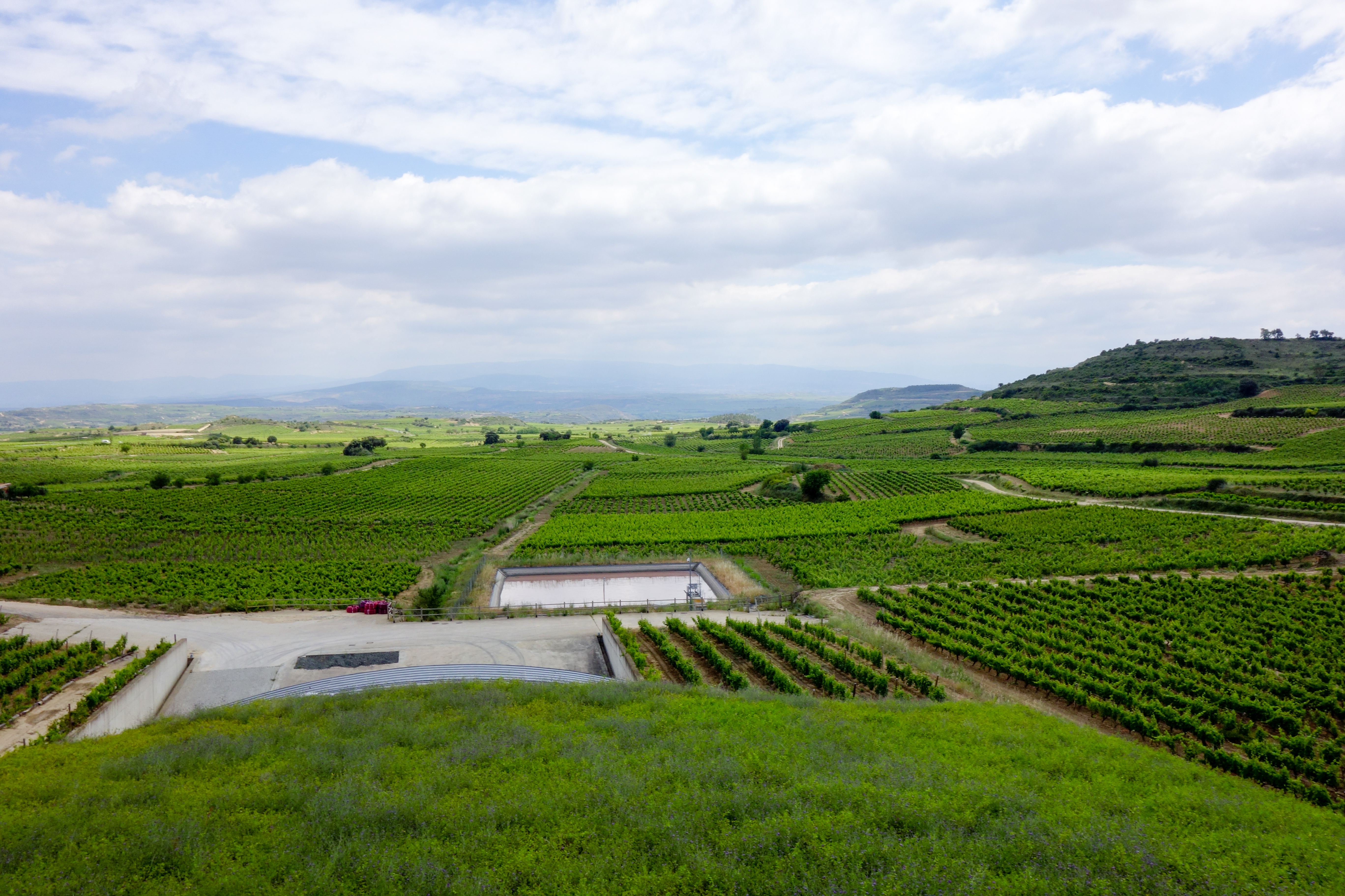
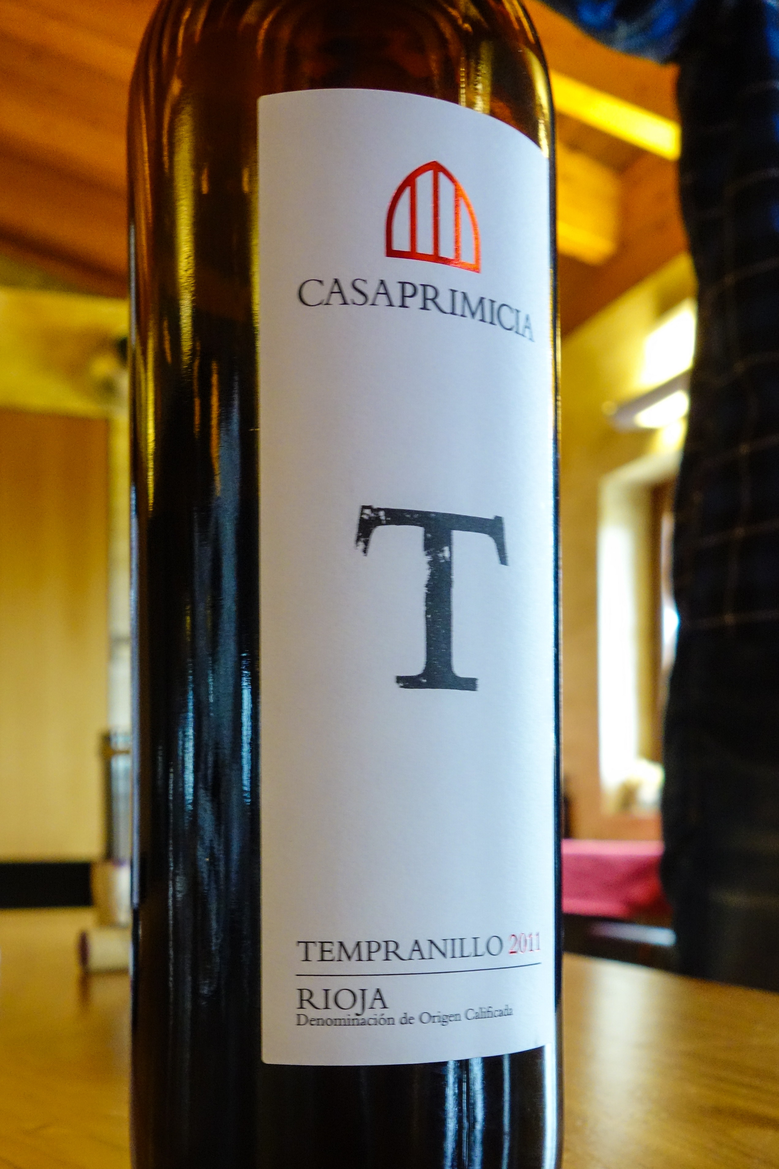
Though I liked all the places we stopped, I particularly liked going through the Basque and Rioja wine regions. I’ve included a photo of me along the way in that area between Laguardia and Haro. It was one of my favorite routes/days. Low traffic, winding through vineyards with great weather. What more do you want as a cyclist?
The map here plus the stats below that follow came from a little Garmin bike computer I took along. The elevation profile below is telling. While clearly not a flat route, the terrain is not mountainous. We never got over 5000 feet of elevation. But there were days that had a bit more elevation gain.
From left to right, that first spike in the elevation profile was the route into Laguardia.
The tour was done in two week-long editions. You could do either one, or both. I and 4 others did both. The rest of the tour group – another dozen – met us mid way and did the latter half of the route. As you can see from the elevation profile, the 2nd half of the tour had a couple more interesting climbs. That said, only a couple few of us actually did those climbs. The tour group arranged for transport for most on that spike in the middle. Most chose that as a hiking day along the Camino. The climb wasn’t that bad though. And yet I was glad that we went up the direction we did. Note the backside of that mid spike in the elevation profile. It was a very steep descent!
That long and mostly flat section in the middle of the elevation profile was referred to as The Meseta. The inner plateau. It had everything from vineyards, to sunflowers, poppies and wheat fields. Our longest day of 70 miles was on the Meseta. The photo included above in this posting of the open road and wide open spaces was on the Meseta.
You can also see some of the tour group below. One of the guys snapped a good shot of us on our way to the last group dinner.

Cycling Through Rioja

Last Dinner Group
The Stats